MapBiomas Alerta
A system that receives, validates, refines, and publishes notices about the suppression or degradation of native vegetation in all biomes.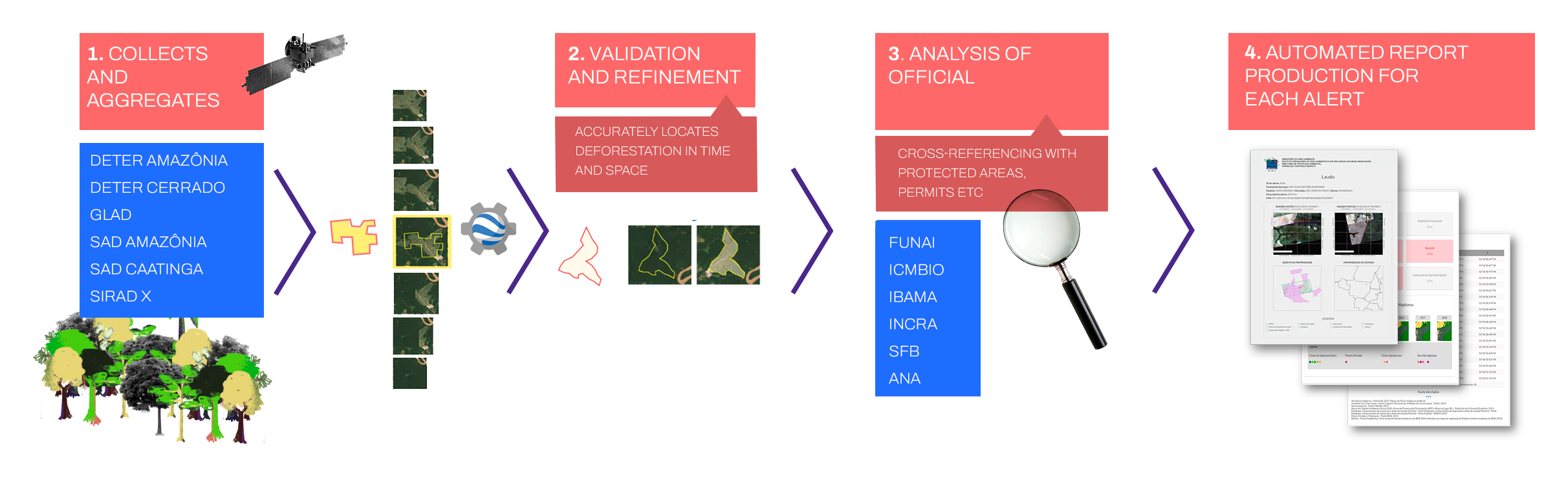
MapBiomas Alerta is a system for capturing, validating, and refining deforestation, degradation, and regeneration alerts for native vegetation in all biomes. The current version is exclusively dedicated to the theme of deforestation in all Brazilian biomes. Other themes (degradation and regeneration) will be incorporated in the next two years. The mechanism is updated monthly and uses high-resolution images generated by various satellite monitoring systems, whether official, non-governmental, or linked to educational and research institutions. The alerts are crossed with databases such as the Rural Environmental Registry (CAR), the National Registry of Conservation Units (CNUC), indigenous lands, and other geographic boundaries, such as biomes, states, hydrographic basins, and the like. On its platform, it is possible to check high-resolution alerts, the status of an area before and after deforestation, and even obtain complete reports on the status of vegetation on rural properties involved in an alert.
See also:
http://alerta.mapbiomas.org/sobre-o-projeto
http://alerta.mapbiomas.org/
https://plataforma.alerta.mapbiomas.org/mapa